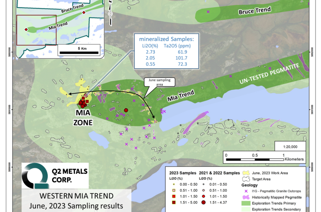
Jun 29, 2023 | News
A property-wide hyperspectral interpretation of ASTER and Sentinel-2 data was completed during May and June by Terra Resources of Perth, Australia. The results of the survey generated 495 target areas on both the Mia Property and the Stellar Property. Read the full announcement...
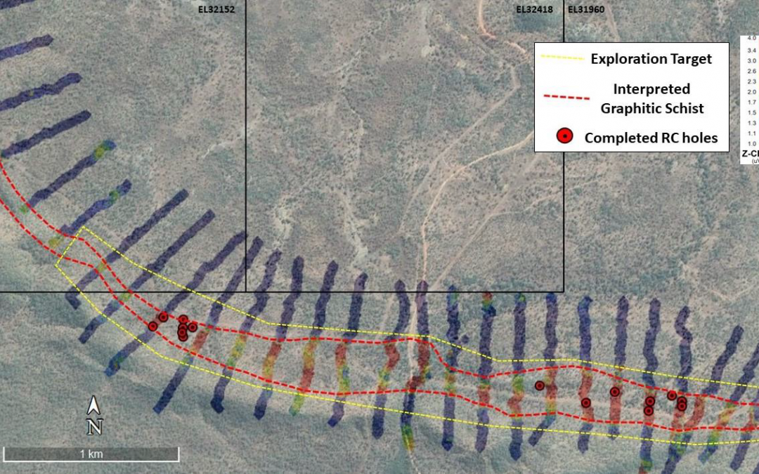
Jun 6, 2023 | News
The survey was completed over the area which underpins the Leliyn Exploration Target and has proven to be very successful in delineating the graphitic schist unit, which returned a high EM response. The EM response over yet to be drilled ground is similar to that where holes that have been drilled previously have significant graphitic schist intersections. Read the full announcement...
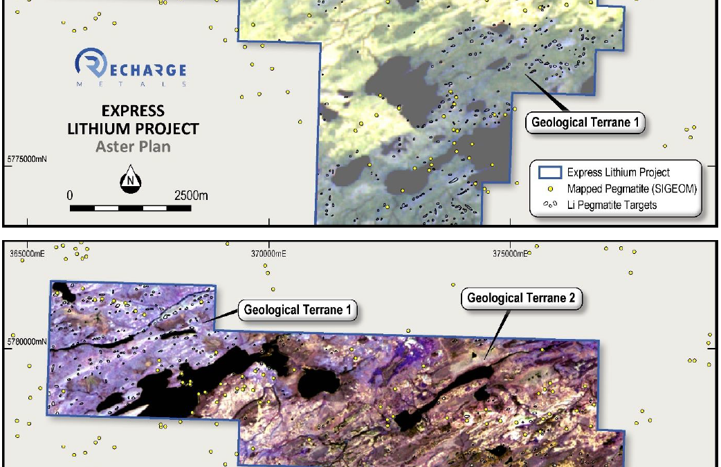
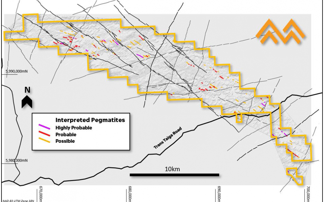
May 18, 2023 | News
Spectral data over the Express Lithium Project has been acquired and interpreted by Terra Resources and the analysis has revealed a substantial number of targets identified which represent potential outcropping pegmatites. The pegmatite targets fall into three (3) main areas and are oriented along the regional structural trends. Read the full announcement...
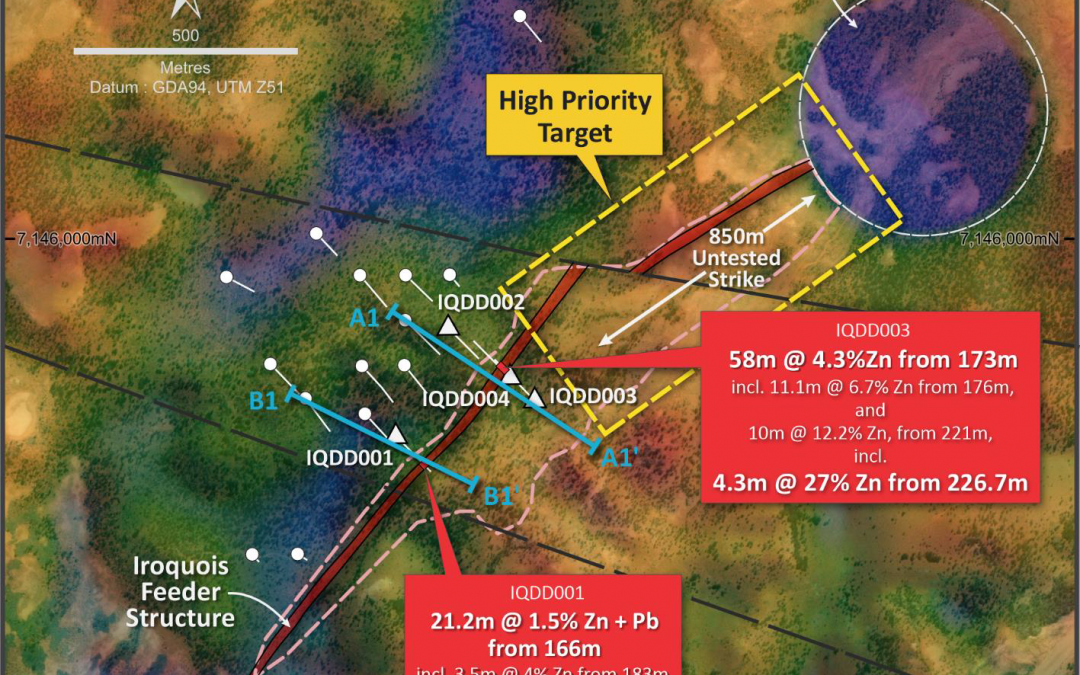
May 17, 2023 | News
Drilling of two holes (IQDD001 and IQDD003) successfully intersected the ‘feeder structure’ in the basement. The 3D inversion of gravity data and QA/QC of the IP data was completed by Terra Resources. Read the full announcement...
May 15, 2023 | News
Megado recently engaged independent geological remote sensing consulting group, Geosense, to conduct a detailed interpretation of high-resolution satellite imagery over its Cyclone Lithium Project. A number of the pegmatites interpreted by Geosense overlap with the spectral targets previously identified by Terra Resources, thus providing high level of confidence that there are lithium bearing pegmatites in the project area. Read the full announcement...

Apr 17, 2023 | News
Terra Resources was engaged by Megado to conduct a detailed interpretation of hyperspectral imagery targeting lithium bearing pegmatite within the project area. Terra has a track record of successfully identifying lithium occurrences from remote sensing datasets, particularly in the James Bay Region. The interpretation by Terra relied on Aster and Sentinel-2 satellite imagery, in conjunction with proprietary algorithms that target lithium bearing pegmatites. Read the full announcement...